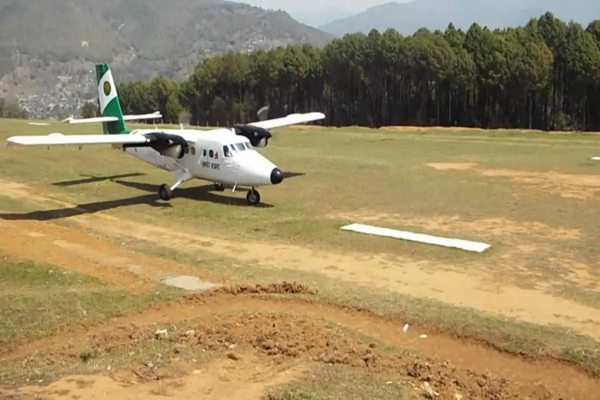
A Twin Otter at Balewa Airport during one of the brief 2018 operating windows. Photo: Aviation Nepal.
If you go looking for Baglung Airport on a current flight schedule, you won't find it. The runway is paved. The fence is up. There's a staffer who turns up to keep the place from going to seed. There just aren't any planes.
That gap between what was built and what's actually running is the whole story here. In April 2021 a contractor finished blacktopping a 700-metre tarmac on a ridgeline east of Baglung Bazaar, at a price tag of NPR 82.4 million. The same project added 1,500 metres of perimeter fence with two gates and 620 metres of concrete drainage. Nothing has landed on any of it since.
Ward 14 chair Chakra Bahadur Khatri put it bluntly to The Kathmandu Post in October 2024: the airport had been left abandoned, and grass was taking over.
This is the long version of how a community-built airstrip from the 1960s ended up paved, fenced, drained, and still empty in 2026. Most of what's been written in English is short. The full picture, with the closures, the false starts, the road that nobody fixed, is longer.
Is Baglung Airport Operating in 2026?
No. There has been no scheduled commercial service since the 2018 closure. A single staffer maintains the facility. No carrier currently operates the route, and no carrier has been formally signed up to start.
If you actually need to get to Baglung District, here are the options that work:
Option | Duration | Approximate Cost |
|---|---|---|
Bus from Pokhara | 3 to 4 hours | NPR 400 to 600 |
Private vehicle from Pokhara | 2.5 to 3 hours | NPR 2,500 to 3,500 |
Charter helicopter from Pokhara | 15 to 20 minutes | USD 800 to 1,200 per flight |
Scheduled fixed-wing service | Not available | N/A |
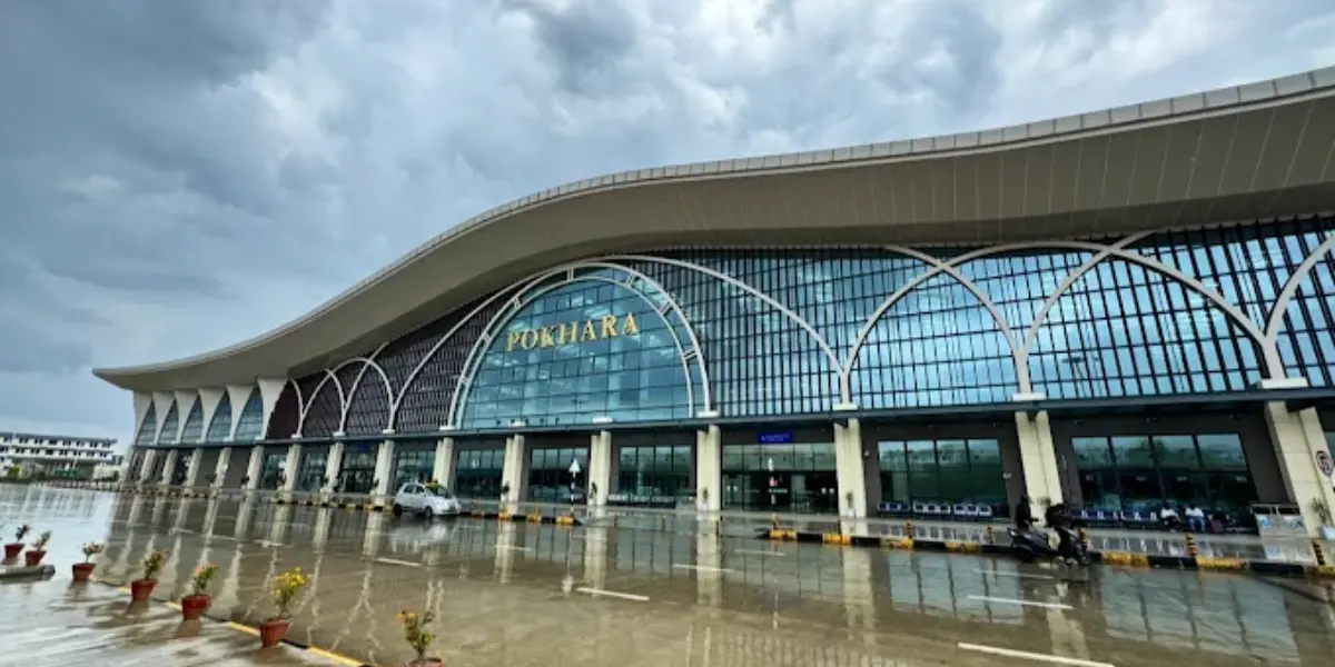
Pokhara to Baglung Bazaar by road covers about 72 kilometres.
The Airport, in Specifications
Baglung Airport (IATA: BGL, ICAO: VNBL) sits in Narayansthan, Ward 14 of Baglung Municipality, around 6 kilometres east of Baglung Bazaar in Gandaki Province. The local name is Balewa.
Elevation: 3,320 ft (1,012 m) above mean sea level
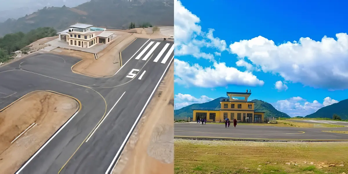
Runway length: 608 metres usable, set within a 1,100-metre gravel field. The blacktopped tarmac is 700 metres long and 24 metres wide.
Surface: Blacktopped, April 2021. Unused since.
Perimeter fencing: 1,500 metres, rusting
Drainage: 620 metres of concrete
Distance from Baglung Bazaar: about 6 km
Access road: 10 to 12 km from Maldhunga, gravel, prone to landslides three years running
How It Compares to the Other Airports in This Part of Nepal
Feature | Baglung (BGL) | Jomsom (JMO) | Pokhara (PKR) |
|---|---|---|---|
Elevation | 3,320 ft / 1,012 m | 8,976 ft / 2,736 m | 2,712 ft / 826 m |
Runway | 608 m usable | ~1,000 m | 2500 m |
Surface | Blacktopped (unused) | Unpaved | Paved |
Status 2026 | Inactive | Operational | Operational |
Flight time to Pokhara | ~8 minutes (historical) | ~25 minutes | N/A |
Flight time to Kathmandu | ~45 minutes (historical) | ~60+ minutes | ~25 minutes |
The strip sits on a ridge above the Kali Gandaki valley, which means approaches cross over one of the deepest river gorges anywhere. Mountain flying conditions here are real. Afternoon valley thermals get bumpy, and the monsoon brings strong upwinds from the south. Pilots flying the 2018 service flagged that better surface preparation and more tree clearance would be needed for confident monsoon-season operations.
How an Empty Airport Ended Up Here: A History
Most English-language summaries of Baglung run to three sentences. The actual history runs across six decades and a lot of community work that hasn't been properly captured.
Built by Locals in the 1960s
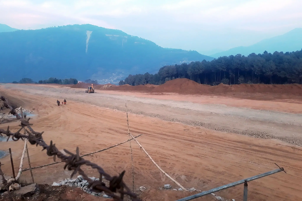
The runway under construction. Photo: DCnepal / The Kathmandu Post.
Sources don't quite agree on when the airstrip was built. The Kathmandu Post puts it at 1959 to 1961. myRepublica and Aviation Nepal say 2018 BS, which lines up with 1961. Tourism Info Nepal and DCnepal both put it at 2022 BS, or 1965. What everyone does agree on is who built it. Local residents, by hand, during the Panchayat era. No heavy machinery, no government contractor. Aviation was the only practical way in or out of Baglung at the time, and the community treated it accordingly.
The Twin Otter Years
From the mid-1960s through the early 1990s, Royal Nepal Airlines ran Twin Otters from Balewa to Pokhara, Kathmandu, and Bhairahawa. Pokhara was eight minutes by air. Kathmandu was about 45 minutes via Pokhara. People used it for medical evacuations, for trade, and for keeping their connections to the capital alive. It was a working route, not a novelty.
The Highway, and What It Did to the Flights
Then the Pokhara to Baglung Highway was finished. Sources put the date somewhere between 1991 and 1993. A bus ticket was a fraction of an air fare, and the road, even slow, was reliable. Demand for flights collapsed within months. Airlines pulled out. The runway sat empty for the next 25 years and was used as cattle grazing land.
2014: A Ministerial Visit That Went Nowhere
In 2014, two ministers (Tourism's Lokendra Bista and Education's Dinanath Sharma) flew into Balewa on a Nepal Airlines Twin Otter, tail number 9N-ABX, captained by senior captain Subash Rijal. The flight from Pokhara took 13 minutes. There were photos and statements about restoring regular service. There were no scheduled flights afterward. The pattern of ministerial visits followed by nothing is going to come up again, so it's worth marking it here.
14 March 2018: The Reopening, with Flowers
On 14 January 2018, CAAN, Tara Air, Nepal Airlines Corporation, and Baglung Municipality signed a tri-party agreement to reopen the airport. Two months later, on 14 March, Tara Air flew its 19-seat Twin Otter (registration 9N-AKL) into Balewa for the first test flight in 26 years. The crew, per myRepublica, was Captain Santosh Shah, Co-Pilot Prabhat Ghimire, and air-hostess Sirjana Humagain.
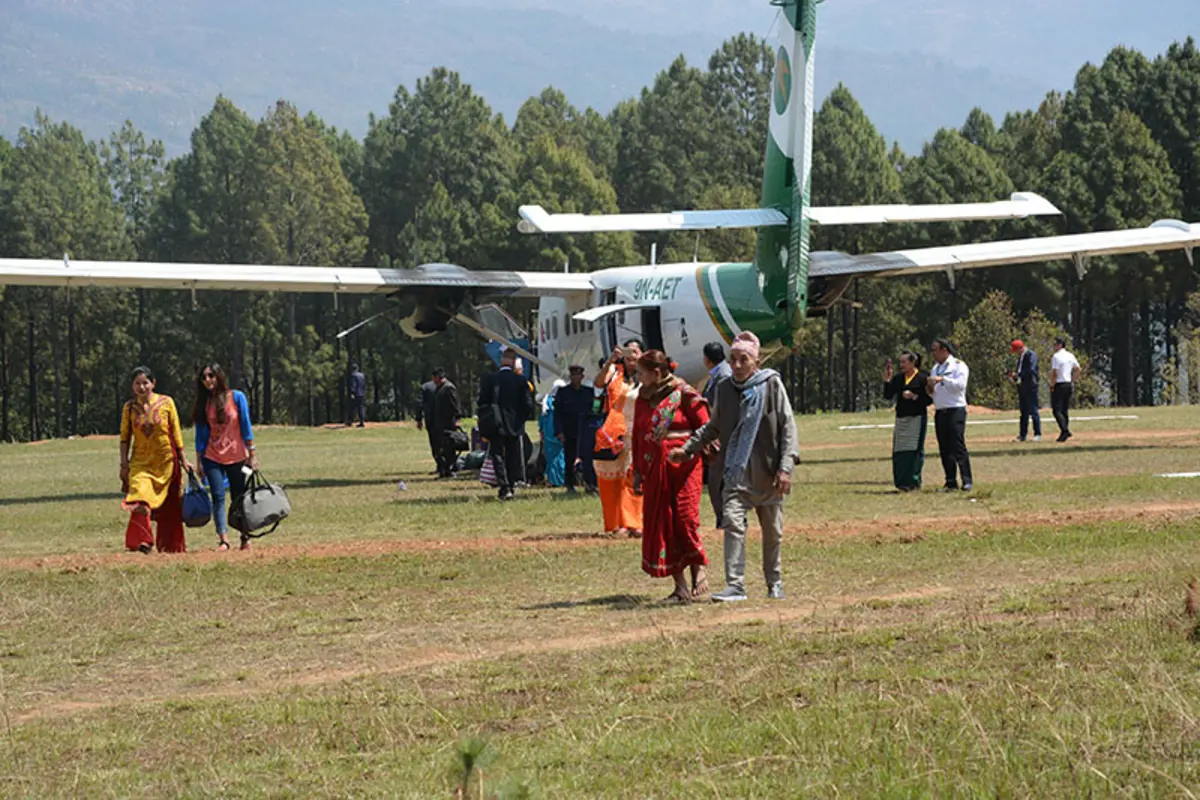
Passengers and locals around a Twin Otter at Balewa during the 2018 reopening. Photo: Aviation Nepal.
Locals waited on the ridgeline with garlands. Spotlight Nepal reported residents saying the flight made good on a dream they'd been carrying for almost three decades. To get the runway flyable again, the community had cleared more than 700 trees in the months before, of which over 400 were Salla pine. Those trees had been growing back since 1993.
March to June 2018: One Operating Window
Regular service started on 23 March 2018. Tara Air and Nepal Airlines Corporation each flew the route once a week, Sundays and Thursdays, on the 18-seat Twin Otter. The two airlines each put down NPR 1 million as refundable deposits with Baglung Municipality. The municipality, in turn, agreed to compensate the carriers for any flight that took off with fewer than around 12 seats sold, the contractual passenger threshold.
The seats didn't fill. By mid-June 2018, after about three months of operation, the flights stopped. The Kathmandu Post later described the run as “nearly four months” and Tourism Info Nepal as “less than six months;” the underlying source data points to roughly 12 weeks of regular service. The municipality ended up paying out approximately NPR 1 million each to Tara Air and to Nepal Airlines to cover empty-seat losses, a total of around NPR 2 million. The ticket counter at the district postal office was taken down. Audits later flagged the subsidy arrangement as procedurally questionable.
April 2021: NPR 82.4 Million for a Runway That Hasn't Hosted a Flight
After the 2018 closure, the municipality went after the surface itself. Carriers had been pointing to the muddy unpaved runway as the reason the route wasn't viable. Pave it, the logic went, and the operating economics change.
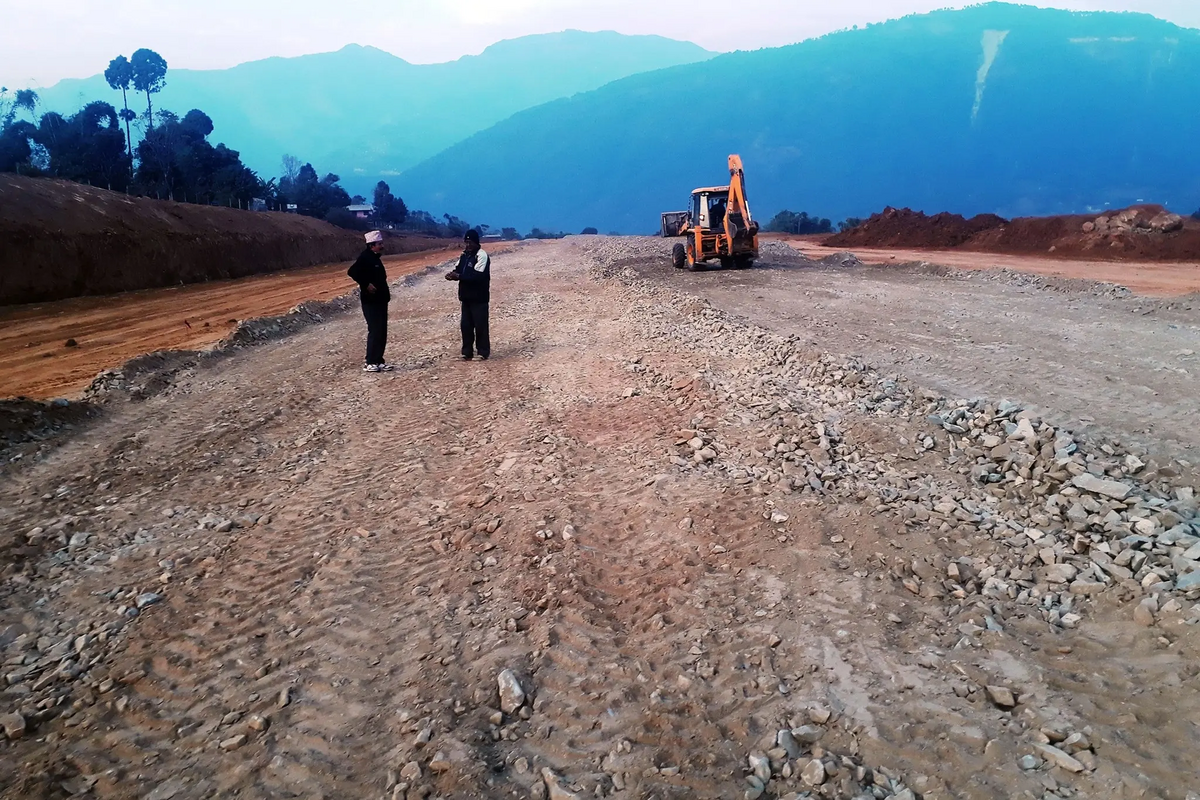
Construction in progress, with the new perimeter fencing going up in the foreground.
Kasthamandap Uma and Joint Venture Construction Company finished the blacktopping in April 2021 at a cost of NPR 82.4 million. (Earlier reporting put the figure at NPR 80.24 million.) The package included the 700-metre tarmac, the 1,500-metre perimeter fence with main and emergency gates, and the 620-metre concrete drainage system. Aircraft up to 18 to 24 seats can use the strip.
No commercial aircraft has landed since.
2024 to 2026: Photos Through the Wire
The Kathmandu Post went back to Balewa in October 2024 and Tourism Info Nepal followed up a year later. Both reports said the same thing. Grass through the tarmac. A rusting fence. One staffer keeping the place tidy. Visitors photographing the empty strip from outside the wire and posting the pictures online, asking when flights will come back. Nobody has an answer.
“For now, grass has grown all over the place, and visitors joke about it,” Khatri said.
Why It's Still Empty
There are two real problems and one structural one. They feed into each other, which is most of why the renovation alone hasn't moved anything.
The road, more than the runway
Two roads connect Maldhunga to the airport. Both have collapsed under monsoon landslides for three consecutive years. During monsoon they're impassable and travellers walk. The municipality has been clearing slide debris at its own cost for years just to keep them open the rest of the time.
A blacktop contract has been awarded for a 10-kilometre stretch of the Kaligandaki Corridor from Maldhunga to Balewa. Until that's done, and until the road actually stays passable through monsoon, no airline will run a route where passengers can't reliably get to the airport. The NPR 82.4 million spent on the runway didn't include any of this. The blacktopped section between Maldhunga and Panitanki is also still affected by recurring slides.
Khatri's framing is the right one. “Only once the road is paved will we be able to start flights. Political leaders are not showing any interest, and there is no possibility of conducting services for lack of access roads.”
Airlines need a demand case, and 2018 didn't make one
Former airport manager Surya Bahadur Khatri said the carrier position cleanly: airlines prioritize routes that ensure profitability, and without passenger assurance, no company wants to take the risk. The 2018 experiment is the cleanest data point we have. The municipality underwrote a passenger threshold and backed it with subsidy payments, and the route still collapsed inside three months. Until the access road is fixed, the demand case can't be built, because passengers can't reliably get to the airport in the first place.
And the structural piece nobody owns
The land belongs to CAAN, which is federal. The road sits in a different jurisdiction. Subsidy decisions are central-government calls. The municipality has none of those levers. Mayor Basanta Kumar Shrestha has said directly that the municipality alone can't revive the airport, and that federal, provincial, and local governments need to coordinate. They haven't, in three decades of trying.
Deputy mayor Raju Khadka has noted that a working airport here would serve the whole Dhaulagiri region. That's Baglung, Parbat, and Myagdi combined, with a population over 400,000. Three districts share the catchment. None of the three tiers of government has put a coordinated plan together.
What's Around Baglung, If the Airport Ever Comes Back
The economic case for reviving Balewa rests on the surrounding tourism corridor, which is genuinely strong and hasn't been mapped against the airport in any operator's route plan.
Destination | Distance from Baglung | Category |
|---|---|---|
Dhorpatan Hunting Reserve | ~65 km southwest | Wilderness / Wildlife |
Tatopani hot springs, Kali Gandaki | ~30 km north | Natural / Therapeutic |
Nisikhola valley | ~20 km east | Trekking |
Galeshwar Temple | ~5 km | Cultural / Sacred |
Ridi Bazaar confluence | ~40 km southwest | Pilgrimage |
Kusma suspension bridge | ~10 km | Adventure |
Dhorpatan Hunting Reserve
Dhorpatan is the only legal hunting reserve in Nepal. It covers 1,325 square kilometres across Baglung, Myagdi, and East Rukum, in the Dhaulagiri Himal. The reserve was established in 1983 and gazetted in 1987. It supports populations of blue sheep (bharal), Himalayan tahr, and a small number of snow leopard.
Hunting permits are issued by the Department of National Parks and Wildlife Conservation. Permit fees vary by species and quota year, and full guided hunts include helicopter charter, government observers, professional hunters, and camp logistics on top of the permit itself. Outfitter pricing is not publicly standardized; readers planning a hunt should contact DNPWC and a licensed outfitter directly. Currently, getting from Pokhara to Dhorpatan means a long road journey followed by trekking, or a helicopter charter.
Pilot Training and Adventure Aviation
Baglung Municipality has separately floated the idea of using Balewa as a pilot training centre and an ultralight base. Nepal does have steady demand for STOL-rated pilots, and a 608-metre blacktopped strip at 1,012 metres elevation is a reasonable training environment for mountain flying certification. Neither idea has been formally costed in any public CAAN document or operator route plan that's available.
For more travel guides and aviation explainers from Nepal and beyond, the rest of the airgazette collection is here.
What's Actually Stuck
The runway works. The fence is up. The drainage is in. The thing that's missing is the road, and the political coordination to fund and protect it through monsoon. That's not a content gap or a marketing gap. It's a procurement and jurisdictional one, and it's been stuck for thirty years.
The community that built Balewa in the 1960s cleared 700 trees in 2018 to bring it back. They watched the reopening collapse inside three months. They watched NPR 82.4 million get spent on a surface that hasn't seen a plane since. Whoever finally moves this one forward isn't going to be moving concrete. They're going to be fixing a road.
FAQs
Can I land a private aircraft at Baglung Airport?
In principle the runway can take aircraft up to 18 to 24 seats, so light private types are within the airfield's certified envelope. In practice, no scheduled or charter operator currently uses it, and CAAN has not issued recent NOTAMs covering active operations there. Anyone considering a private movement would need to clear it directly with CAAN's Pokhara office, and would need to satisfy themselves about ground services, fuel availability (none on site), and the unstaffed approach environment. A pre-flight call to the Baglung Municipality office is also worth doing because of the access road conditions for ground crew and passengers.
Is the runway certified for night operations or instrument approaches?
No. Baglung is a daylight, visual flight rules airfield. There is no installed approach lighting, no published instrument procedure, and no air traffic control on site. The strip is administratively overseen from Pokhara Airport. During the 2018 operating period, all flights were day-VFR Twin Otter operations.
What's the practical operating ceiling for a Twin Otter at Balewa in monsoon conditions?
The DHC-6 Twin Otter has no issue with the field elevation itself (1,012 metres is well within its performance envelope). The constraints at Balewa are field length, surface condition, and weather. The 608 metres of usable runway is short for full-payload operations, and the pilots flying the 2018 service flagged that the surface and surrounding tree clearance were not yet at a standard they were comfortable with for confident monsoon operations. Strong south-facing upwinds and afternoon thermals over the Kali Gandaki gorge add to the workload. In practice, monsoon dispatch reliability at Balewa would be marginal even with a fully prepared surface.
Are there any current plans by Tara Air, Nepal Airlines, or Summit Air to resume the Baglung route?
There is no publicly announced plan from any operator as of 2026. No carrier has been formally engaged by either CAAN or the municipality, and the 2018 subsidy arrangement has not been re-tabled. Local officials have repeatedly tied any revival to completion of the Maldhunga to Balewa road blacktopping.
Is Baglung Airport open right now in 2026?
No. There is no scheduled commercial service. The runway is paved and the facility is maintained by a single staff member, but no airline operates the route.
How do I actually get to Baglung if I can't fly?
Bus from Pokhara takes 3 to 4 hours and costs roughly NPR 400 to 600. A private vehicle does the trip in 2.5 to 3 hours for NPR 2,500 to 3,500. Charter helicopter from Pokhara is 15 to 20 minutes and runs around USD 800 to 1,200 per flight. The road distance is about 72 km.
Why was the runway paved if no airline was lined up to use it?
The municipal logic in 2020 was that the unpaved surface was the reason carriers had been declining the route, so paving was a precondition. The completion of the access road, which is the binding constraint for actual operations, was treated as a separate project under a different jurisdiction. That sequencing is most of why the airport sits unused now.
Who owns the land, and who would have to sign off on a revival?
The airport land belongs to CAAN (federal). The access road sits under a different government tier. Airline subsidies are a central-government call. The municipality holds none of these levers on its own, which is why every local official quoted on the topic eventually points to coordination among federal, provincial, and local government.